By Patrick Higgins
I just happened to be leading a combined tram tour and swamp walk on the 29th of January when the Park’s Burn Specialist, Steve Houseknecht, and his team were setting Lee-Cypress Prairie ablaze. It was of course a prescribed burn, in this case of some 400 acres from the road to the margins of the swamp beyond.
Trundling down Janes Scenic Drive on the Ghost-rider, our passengers had a front row view of the burn crew, decked out in their helmets and yellow Nomex jackets, igniting the dry grasses and shrubs with their drip-torches. We traversed a smouldering landscape with flames lapping at hammocks in the distance. Hawks moved from perch to perch just ahead of the fire head watching for fleeing prey or perhaps some fresh barbeque. Later, wading in Six Pipe Slough we had the novel experience of snow in the Fakahatchee, as white ash rained down upon us.
South Florida is the lightning capital of the USA with an average of 25 lightning strikes per square mile and more thunderstorm days than anywhere else in the country. This, coupled with seasonal drying, makes wildfire a natural component of our environment. As a consequence most of our ecosystems have evolved to be fire dependent.
The majority of lightning strikes are between June and September, coinciding with the peak of our wet season, so the resulting fires tend to be lighter in touch and more localized. However wildfires from thunderstorms in late spring, when there’s lots of accumulated dry fuel about, tend to be wider sweeping, more severe, and can even alter the soil structure. But with the creation of roads and canals that act as firebreaks and fragmentation of the habitat, this cycle cannot take its natural course. So we have prescribed burns that attempt to mimic this otherwise natural phenomenon. The Fakahatchee has the largest prescribed burn program in Florida’s State Park system.
Fire maintains the habitat by preventing succession. Without fire, shrubs and trees would invade our marshes and wet prairies, eventually drying them out. Fire releases and recycles nutrients locked up in plant tissue, keeps non-fire adapted invasive plants in check, and alters the landscape spatially, creating clearings and opportunity for burnt areas to experience increases in native wildflowers, birds and other wildlife. In the case of prescribed burns, they also protect Park neighbors and facilities by reducing potential fuel for wildfires.

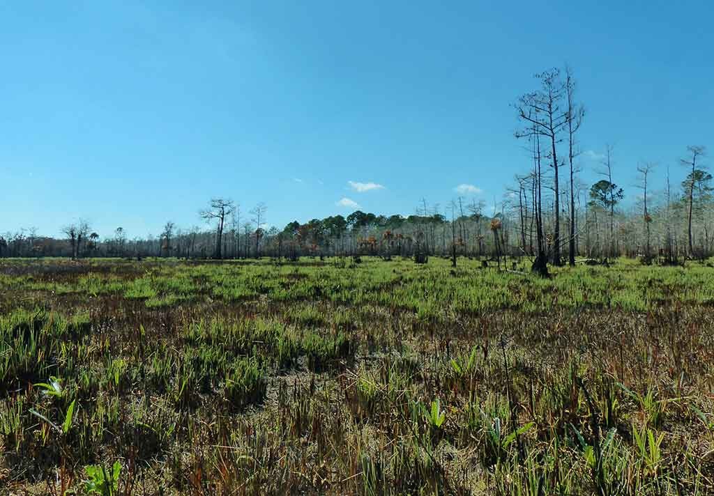
New growth abounds in Lee Cypress Prairie just two weeks after a prescribed burn. Photo by Patrick Higgins.
I tramped across the charred landscape 2 weeks later and was greeted by fresh sweet green shoots of grass already 6 inches high being grazed upon by white-tailed deer. More remarkable were the thistles in flower everywhere, poised to create seeds to colonize new terrain. The burn also revealed some of the prairie’s normally hidden structure like the recumbent trunks of saw palmettos, cap rock, or circles of cypress knees around old logged stumps, as well as a littering of white shells from the previous seasons’ apple snails.
Of particular interest to me was how the prairie hammocks had faired. Many of the smaller islands of cabbage palm and saw palmetto appeared incinerated, although I knew within a few weeks the palmetto’s blackened trunks would be sprouting new fronds. The hardwood hammocks however were largely untouched. Some are protected by shallow perimeter moats, but it’s the deep shade of their interiors that create microclimates with higher humidity that seems to keep them safe. In most cases it was just the volatile wax myrtle around their margins that had burned.
There’s no water in most of the borrow ditch paralleling lower Janes Scenic Drive right now, so the burnt prairie is easy to access. Try investigating it on foot before the grasses gets too high again and compare it with unburnt Copeland Prairie to the east. Personally I’m waiting for autumn when the muhly grass ought to be spectacular. It flowers best after a good burn.
